Click grey rectangles to see full-sized maps
A waterproof printed map and GPS-enabled digital maps for iOS/Android are available from Redwood Hikes Press
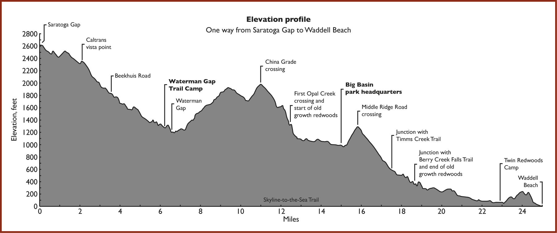
Saratoga Gap route
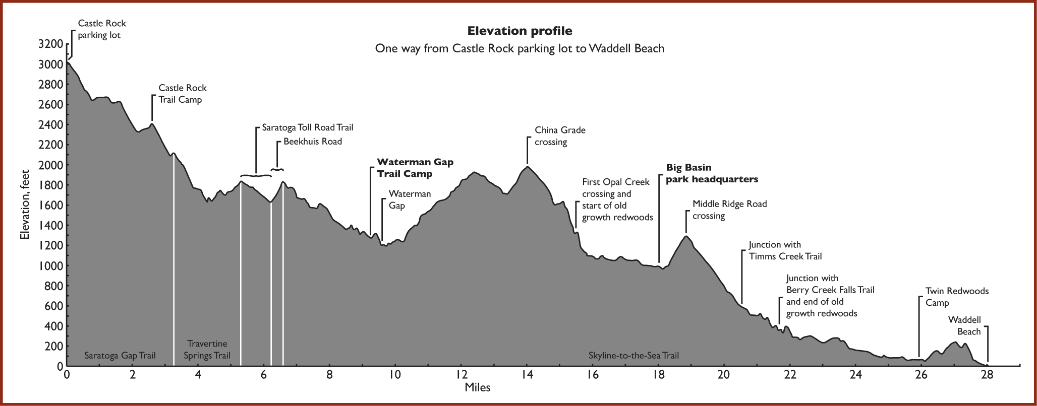
Castle Rock route
| Links to campground pages | |||
| Overall rating | Sites | Price | Trail name |
| * * | 20 | $15 | Castle Rock Trail Camp |
| * * | 6 | $15 | Waterman Gap Trail Camp |
| * * | 8 | $15 | Jay Trail Camp |
| * * * * | 6 | $15 | Twin Redwoods and Alder Trail Camps |